翻刻
【右丁】
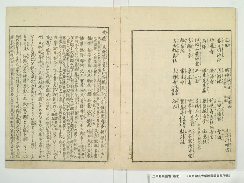
三田(みた) 綱坂(つなさか)《割書:手引坂(てひきさか) 産湯水(うふゆのみつ)|駒繋松(こまつなきまつ) 綱塚(つなつか)》 小山神明宮(こやましんめいくう)
春日明神(かすかみやうしん)社 月波楼(けつはろう) 三田八幡宮(みたはちまんくう) 聖坂(ひしりさか)
功運寺(こううんし) 済海寺(さいかいし) 竹柴寺旧址(たけしはてらきうし)同 古事(こし)
亀塚(かめつか) 徂来先生墓(そらいせんせいのはか) 魚籃観音堂(きよらんくわんおんたう) 潮見坂(しほみさか)
伊皿子薬師堂(いさらこやくしたう) 牛小屋(うしこや) 高輪大木戸(たかなわおほきと)《割書:七月廿六 夜待(やまち)之図| 》
高輪(たかなわ)か原(はら) 泉岳寺(せんかくし) 如来寺(によらいし)《割書:臥竜岡(くわりうのおか)| 》 太子堂(たいしたう)庚申堂(かうしんたう)
稲荷(いなり)祠 常光寺(しやうくわうし) 宝蔵寺(ほうそうし)《割書:子安観音|弁才天》 釈神(しやくしん)社
高山稲荷(たかやまいなり)社 東禅寺(とうせんし)《割書:有喜寿(うきす)|八幡宮》 谷山(やつやま)
【左丁】
武蔵(むさし) 東海道(とうかいたう)に属(そく)す和名類聚楽抄(わみやうるいしゆしやう)曰(いはく)牟佐之(むさしの)国府(こくふ)多磨郡(たまこほり)に在(あり)と云々
《割書:武蔵国(むさしのくに)上古(いにしへ)は東山道(とうさんたう)の内(うち)に入(い)る光仁天皇(くわうにんてんわう)の宝亀(はうき)二年辛亥冬十月己卯|太政官(たいしやうくわん)奏(さう)して東海道(とうかいたう)に属(そく)せしむるよし続日本紀(そくにほんき)に見えたり》久良(くらき)都筑(つゝき)多磨(たま)
橘樹(たちはな)荏原(ゑはら)豊島(としま)足立(あたち)新座(にひくら)入間(いるま)高麗(こま)比企(ひき)横見(よこみ)埼玉(さいたm)大里(おほさと)男衾(おふすま)
幡羅(はら)榛澤(はんさは)那珂(なか)児玉(こだま)賀美(かみ)秩父(ちゝふ)葛錺(かつしか)等(とう)以上(いしやう)二十二 郡(くん)なり《割書:拾芥抄(しうかいしやう)に|大県(おほあかた)東海(とうかい)》
《割書:那珂(なか)等(とう)の三郡を加(くわ)へ葛飾)かつしか)を除(のそき)て廿四郡とすれば詳(つまひらか)ならす貞享(ちやうきやう)三年丙寅三月 利根川(とねかは)の|西(にし)を割(わり)て武蔵国(むさしのくに)に属(そく)せしむ昔(むかし)は本所(ほんしよ)葛西(かさい)の辺(へん)浅草(あさくさ)の川を国界(くにさかゐ)として川(かは)より東(ひかし)の地(ち)は》
《割書:一円(いちゑん)に下総国(しもふさのkに)なりしを右(みき)に《振り仮名:云如く|いふを》今(いま)は葛飾郡(かつしかこほり)の半(なかは)を割(わり)て利根川(とねかは)の以(もつて)西(にし)を武蔵(むさし)の国(くに)の|葛錺郡(かつしかこほり)とす以東(もつてひかし)を下総(しもふさ)の国(くに)の葛錺郡(かつしかこほり)とす和名抄(わみやうしやう)に武蔵国(むさしのくに)管(くわん)二十一とありて葛錺郡(かつしかこほり)なし》
《割書:今(いま)是(これ)を加(くは)へて二十二 郡(くん)とす和名抄(わみやうしやう)葛錺(かつしか)を加止志加(かししか)と訓(くん)す同書(とうしよ)に多磨(たま)も多波(たは)と訓(くん)したり|》
古事記(こしき)牟邪志(むさし)に作(つく)る旧事記(くしき)胸刺(むさし)に作(つく)る《割書:万葉集(まんえふしふ)に牟(む)|射志(さし)に作(つく)る》同くむさしと称(しよう)す
其義(そのき)は風土記抄(ふときしやう)にいふ武蔵(むさし)の国(くに)秩父(ちゝふ)の嵩(たけ)はその勢(いきほ)ひ勇者(いうしや)の怒(いか)り立(たて)るか
如(こと)し日本武尊(やまとたけのみこと)此(この)山(やま)に東夷征伐(とういせいはつ)の祈願(きくわん)をこめ給ひその後(のち)東夷(とうい)尽(こと〳〵)く平治(へいち)
せしかはその武器(ふき)を秩父(ちゝふ)岩倉山(いはくらやま)に納(をさ)め給ふよりてこの国(くに)をむさしと称(しよう)せしと
なり其後(そのゝち)称徳天皇(しようとくてんわう)の神護景雲(しんこけいうん)二年 武蔵(むさし)の国(くに)より白雉(はくち)を献(けん)しけるか公(く)
卿(きやう)の奏(そう)せし言(ことは)に戢(をさめ)_レ武(ふを)崇(たつとふ)_レ文(ふんを)の祥(しやう)なりといふよりて此国(このくに)を武蔵(むさし)の字(し)を以(もつて)嘉名(かめい)となし給ふといふ
続日本紀(そくにほんき)称(しよう)徳 紀(きに)云(いはく)神護景雲(しんこけいうん)二年六月癸巳云云 武蔵国(むさしのくに)橘樹郡(たちはなこほりの)人(ひと)飛鳥部(あすかへの)吉志(きし)五百国(いをくに)於(おいて)
現代語訳
【右丁】
三田(みた) 綱坂(つなさか)《細字:手引坂(てひきさか) 産湯水(うぶゆのみず)|駒繋松(こまつなぎまつ) 綱塚(つなづか)》 小山神明宮(こやましんめいぐう)
春日明神(かすがみょうじん)社 月波楼(げっぱろう) 三田八幡宮(みたはちまんぐう) 聖坂(ひじりざか)
功運寺(こううんじ) 済海寺(さいかいじ) 竹柴寺旧址(たけしばでらきゅうし)同寺の古い言い伝え
亀塚(かめづか) 徂徠先生墓(そらいせんせいのはか) 魚籃観音堂(ぎょらんかんのんどう) 潮見坂(しおみざか)
伊皿子薬師堂(いさらごやくしどう) 牛小屋(うしごや) 高輪大木戸(たかなわおおきど)《細字:七月二十六日夜待の図| 》
高輪が原(たかなわがはら) 泉岳寺(せんがくじ) 如来寺(にょらいじ)《細字:臥竜岡(がりゅうのおか)| 》 太子堂(たいしどう)庚申堂(こうしんどう)
稲荷祠 常光寺(じょうこうじ) 宝蔵寺(ほうぞうじ)《細字:子安観音|弁才天》 釈神社
高山稲荷社 東禅寺(とうぜんじ)《細字:有喜寿(うきす)|八幡宮》 谷山(やつやま)
【左丁】
武蔵国は東海道に属する。『和名類聚抄』によれば「牟佐之」と記され、国府は多摩郡にあるという。
《細字:武蔵国は上古は東山道の内に入っていた。光仁天皇の宝亀二年辛亥冬十月己卯に、太政官が奏請して東海道に属させたことが『続日本紀』に見える》久良 都筑 多摩
橘樹 荏原 豊島 足立 新座 入間 高麗 比企 横見 埼玉 大里 男衾
幡羅 榛沢 那珂 児玉 賀美 秩父 葛飾等 以上二十二郡である《細字:『拾芥抄』では|大県 東海》
《細字:那珂等の三郡を加え葛飾を除いて二十四郡とするのは詳らかでない。貞享三年丙寅三月、利根川の|西を割いて武蔵国に属させた。昔は本所葛西の辺り、浅草川を国境として川より東の地は》
《細字:一円に下総国であったが、上記のように今は葛飾郡の半分を割いて利根川より西を武蔵国の|葛飾郡とし、以東を下総国の葛飾郡とする。『和名抄』に武蔵国管二十一とあって葛飾郡なし》
《細字:今これを加えて二十二郡とする。『和名抄』では葛飾を「かししか」と訓む。同書では多摩も「たは」と訓んでいる|》
『古事記』では「牟邪志」に作る。『旧事記』では「胸刺」に作る。《細字:『万葉集』では「牟|射志」に作る》同じく「むさし」と称する。
その意義は『風土記抄』にいう。武蔵国の秩父の山はその勢いが勇者の怒り立つような
様子である。日本武尊がこの山で東夷征伐の祈願をこめられ、その後東夷がことごとく平定
されたので、その武器を秩父岩倉山に納められたことから、この国を「むさし」と称したと
いう。その後称徳天皇の神護景雲二年、武蔵国より白雉を献上したが、公
卿の奏上した言葉に「武を戢め文を崇ぶ」の祥瑞なりということから、この国を武蔵の字をもって嘉名としたという。
『続日本紀』称徳紀にいう。神護景雲二年六月癸巳云云 武蔵国橘樹郡の人飛鳥部吉志五百国において
英語訳
【Right Page】
Mita, Tsunasaka (with subsidiary notes: Tebikisaka, Ubuyunomizu spring | Komatsunagi pine, Tsunazuka) Koyama Shinmei Shrine
Kasuga Myōjin Shrine, Gepparo pavilion, Mita Hachiman Shrine, Hijiri slope
Koun-ji temple, Saikai-ji temple, Former site of Takeshiba-ji temple and its ancient legends
Kamezuka (turtle mound), Grave of Master Sorai, Gyoran Kannon Hall, Shiomizaka slope
Isarago Yakushi Hall, Ushigoya (cow shed), Takanawa Ōkido (great gate) (with subsidiary note: Illustration of night vigil on July 26th)
Takanawa plain, Sengaku-ji temple, Nyorai-ji temple (with subsidiary note: Garyū hill), Taishi Hall, Kōshin Hall
Inari shrine, Jōkō-ji temple, Hōzō-ji temple (with subsidiary note: Koyasu Kannon | Benzaiten), Shakujin shrine
Takayama Inari shrine, Tōzen-ji temple (with subsidiary note: Ukisu | Hachiman shrine), Yatsuyama
【Left Page】
Musashi Province belongs to the Tōkaidō circuit. According to the Wamyō Ruijushō, it is written as "Musashi," and the provincial capital is located in Tama district.
(Subsidiary note: Musashi Province was originally included within the Tōsandō circuit in ancient times. In the winter, tenth month, day kinotō of the second year of Hōki (771) during Emperor Kōnin's reign, the Daijōkan petitioned to transfer it to the Tōkaidō circuit, as recorded in the Shoku Nihongi.) Kuraki, Tsuzuki, Tama
Tachibana, Ebara, Toshima, Adachi, Niikura, Iruma, Koma, Hiki, Yokomi, Saitama, Ōsato, Osuma
Hara, Hanzawa, Naka, Kodama, Kami, Chichibu, Katsushika and others - a total of twenty-two districts (Subsidiary note: The Shūgaishō lists | Ōagata, Tōkai)
(Subsidiary note: Adding the three districts of Naka and others while removing Katsushika to make twenty-four districts is not clear. In the third month of the third year of Jōkyō (1686), the west side of the Tone River was divided and made to belong to Musashi Province. In the past, around Honjo and Kasai, with the Asakusa River as the provincial border, the land east of the river)
(Subsidiary note: Was entirely part of Shimōsa Province, but as mentioned above, now half of Katsushika district has been divided so that west of the Tone River belongs to Musashi Province's Katsushika district, while the eastern part belongs to Shimōsa Province's Katsushika district. The Wamyōshō lists twenty-one districts under Musashi Province's jurisdiction without Katsushika district)
(Subsidiary note: Now this is added to make twenty-two districts. The Wamyōshō reads Katsushika as "kashishika." The same book also reads Tama as "taha.")
The Kojiki writes it as "Muyashi." The Kyūjiki writes it as "Munasashi." (Subsidiary note: The Man'yōshū writes it as "Mu|sashi") All are pronounced as "Musashi."
Its meaning is explained in the Fudoki-shō. The peaks of Chichibu in Musashi Province have a force like that of brave warriors rising in anger.
Prince Yamato Takeru offered prayers at this mountain for the conquest of the eastern barbarians, and after the eastern barbarians were completely pacified,
he stored his weapons at Mount Iwakura in Chichibu, which is why this province came to be called "Musashi."
Later, in the second year of Jingō Keun during Empress Shōtoku's reign, when Musashi Province presented a white pheasant, the court nobles' memorial stated it was an auspicious sign of "storing away weapons and revering culture," thus this province was given the auspicious name using the characters for Musashi.
The Shoku Nihongi, in the Shōtoku chronicles, states: "Second year of Jingō Keun, sixth month, day mizunoto-mi... A person from Tachibana district in Musashi Province, Asukabe no Kishi Iokuni, at..."