翻刻
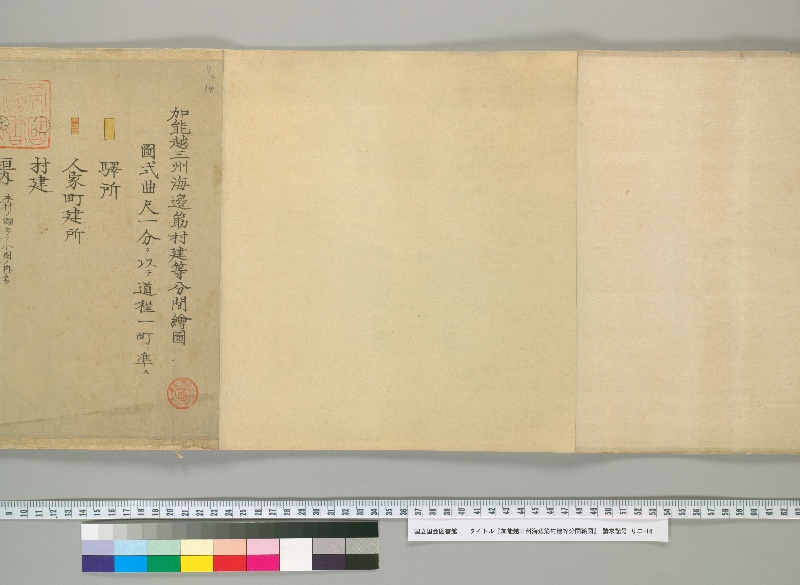
加能越三州海邊筋村建等分間繪圖 【受入登録印】#1
圖式曲尺一分ヲ以テ道程一町ニ準ス
【黄色】驛所
【黄色赤線網】人家町建所
【○】村建
現代語訳
加賀・能登・越中三州海辺筋村建等分間絵図 【受入登録印】
図式 曲尺一分をもって道程一町に準ずる
【黄色】駅所
【黄色赤線網】人家町建所
【○】村建
英語訳
Detailed Survey Map of Coastal Villages in the Three Provinces of Kaga, Noto, and Etchu 【Receipt Registration Seal】
Chart Legend: One bu of the carpenter's square corresponds to one chō of distance
【Yellow】Post stations
【Yellow with red hatching】Residential town areas
【○】Village settlements