翻刻
【右丁】
故(ゆゑ)にかく称(しよう)すといふ
小野宮村(をのゝみやむら) 陣街道(ちんかいたう)を隔(へた)てゝ分倍(ふんはい)より艮(うしとら)に当(あた)れる地(ち)をしかいふ《割書:府中本(ふちゆうほん)|宿(しゆく)の内(うち)》
《割書:僅(わつか)に家数(いへかす)三十 軒(けん)はかりの|間(あひた)をも小野宮(をのゝみや)とよへり》小野(をの)は上古(しやうこ)郡村(くんそん)定(さたま)らさる時(とき)よりの号(な)にして
小野県(をのゝあかた)と称(しやう)せしもの是(これ)なり今(いま)は府中(ふちゆう)の舊名(きうみやう)となれり和名類聚(わみやうるいしゆ)
抄(しやう)に多磨郡(たまこほり)小野(をの)乎乃(をの)とあり《割書:此地(このち)墾田(こんてん)となりしは元亀(けんき)天正(てんしやう)の頃(ころ)にして|小野宮(おのゝみや)の耕田(かうてん)をさして向田(むかひた)といふ田地(てんち)》
《割書:開発(かいほつ)の始(はしめ)は漸(やうやく)田数(たかす)五反(たん)程(ほと)ありしとて土人(としん)五反田(こたんた)と字(あさな)せりといふ又(また)小野宮(をのゝみや)の|北(きた)田間(てんかん)の塚(つか)は中古(ちゆうこ)の甲州街道(かうしうかいたう)府中(ふちゆう)より日野(ひの)へ往還(わうくわん)の一里塚(いちりつか)にして今(いま)も其(その)野径(のみち)を|古街道(こかいたう)と唱(とな)ふ》
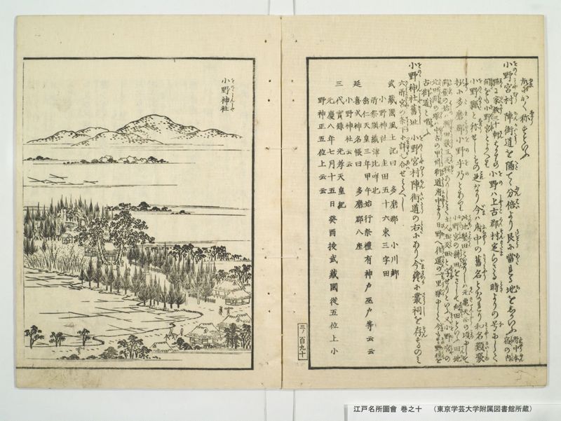
小野神社舊址(おのゝしんしやきうし) 小野宮村(おのゝみやむら)陣街道(ちんかいたう)の右(みき)にあり今(いま)纔(わつか)に叢祠(さうし)を存(そん)するのみ
六所宮(ろくしよのみや)の条下(てうか)に詳(つまひらか)也 合(あは)せみるへし
武蔵国風土記曰 多磨郡 小川郷
小野神社 圭田五十六束三字田
所祭瀬織津比咩也
垂仁天皇三年甲午始行祭礼有神戸巫戸等云云
延喜式神名帳曰 多磨郡八座
小野神社云云
三代実録 光孝天皇紀
元慶八年七月十五日葵酉授武蔵国従五位上小
野神正五位上云云
【枠外】 三ノ百九十
【左丁】
小野神社(をのゝしんしや)
【四角囲い文字】
本社
みたらし
いなり
現代語訳
【右丁】
ゆえにこのように称するという。
小野宮村 陣街道を隔てて分倍より北東に当たる地をこのように言う。《府中本宿の内》
《わずかに家数三十軒ほどの間をも小野宮と呼んでいる》小野は上古に郡村が定まらない時からの名前で、小野県と称していたものがこれである。今は府中の旧名となっている。和名類聚抄に多摩郡小野(乎乃)とある。《この地が墾田となったのは元亀・天正の頃で、小野宮の耕田をさして向田という田地》
《開発の始めはわずかに田数五反程あったとして、土地の人は五反田と字したという。また小野宮の北の田の間の塚は中古の甲州街道で、府中より日野への往還の一里塚であって、今もその野道を古街道と唱える》
小野神社旧址 小野宮村陣街道の右にあり、今はわずかに小さな祠を存するのみ。六所宮の条下に詳しい。あわせて見るべし。
武蔵国風土記に曰く 多摩郡 小川郷
小野神社 圭田五十六束三字田
所祭瀬織津比咩也
垂仁天皇三年甲午始行祭礼有神戸巫戸等云云
延喜式神名帳に曰く 多摩郡八座
小野神社云云
三代実録 光孝天皇紀
元慶八年七月十五日葵酉授武蔵国従五位上小
野神正五位上云云
【左丁】
小野神社
【四角囲い文字】
本社
みたらし
いなり
英語訳
【Right Page】
Therefore it is called by this name.
Ono-no-miya Village: The area northeast of Bunbai across the Jin Highway is called this. 《Within Fuchū Hon-shuku》
《Even an area with only about thirty houses is called Ono-no-miya》 Ono is a name from ancient times before counties and villages were established, and this is what was called Ono-no-agata (Ono County). Now it has become the old name of Fuchū. The Wamyō Ruijushō lists "Ono (乎乃)" under Tama County. 《This land became cultivated fields around the Genki-Tenshō period, and the cultivated fields of Ono-no-miya are referred to as Mukaida farmland》
《At the beginning of development there were only about five tan of fields, so local people called it Gotanda (Five-Tan Fields). Also, the mound among the northern fields of Ono-no-miya was a one-ri marker on the medieval Kōshū Highway from Fuchū to Hino, and even now that country path is called the Old Highway》
Former Site of Ono Shrine: Located on the right side of the Jin Highway in Ono-no-miya Village. Now only a small shrine building remains. Details are in the section on Rokushō Shrine. See that section as well.
The Musashi Provincial Gazetteer states: Tama County, Ogawa District
Ono Shrine: Keida fifty-six bundles, three-character fields
Deity worshipped: Seoritsu-hime
Ritual ceremonies began in the third year of Emperor Suinin, year of kinoe-uma, with shrine households, shrine maiden households, etc.
The Engi-shiki Shinmei-chō states: Eight shrines in Tama County
Ono Shrine, etc.
Sandai Jitsuroku, Chronicles of Emperor Kōkō:
Eighth year of Gangyō, seventh month, fifteenth day, day of kinoto-tori, granted to Ono Shrine of Musashi Province, from Junior Fifth Rank Upper to Senior Fifth Rank Upper, etc.
【Left Page】
Ono Shrine
【Text in rectangular frame】
Main shrine
Mitarashi
Inari