翻刻
【コマ4】
【右丁】
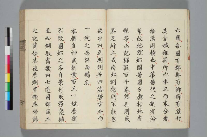
六國_一、每國有_レ郡、郡有_レ郷、郷有_二荘村_一、
其方域雖_レ異、所_二以本立而末分_一者、
倭漢同_レ揆也、中𬜻歷代之制有_二沿
革_一、故地理郡國黄圖方輿括地府
縣等、志記録數百千巻、然其閒或
■#1足峙立、或南北割據、則不能包󠄁《返り点:二》
【左丁】
舉宇内_一、至_下明朝并《返り点:二》四海《返り点:一》𥡳《返り点:中》古今_上、而
一統之志詳而備矣、
本朝自_二神武創業_一、百王一姓歷運
不_レ改、国郡之名自_二景行成務_一寖備、
至和銅馭寓畿内七道國郡風土
之記資始、其後歷朝、有_二損益修飾_一、
現代語訳
【コマ4】
【右丁】
六十六国に分かれ、各国には郡があり、郡には郷があり、郷には荘・村がある。その地域の形や広さは異なるとはいえ、根本が確立されてから末端が分かれるという原則においては、日本も中国も同じ道理である。中国では歴代の制度に沿革(変遷)があり、それゆえ地理・郡国・黄図・方輿・括地・府県などの志・記録が数百・数千巻にのぼる。しかしその間、あるいは(国土が)鼎のように分立し、あるいは南北に割拠することもあり、天下全体を包み挙げることはできなかった。
【左丁】
明朝に至って四海(天下)を併せ、古今にわたって(比較・検討し)、一統(統一)の志は詳細かつ完備したものとなった。
わが本朝(日本)は神武(天皇)が創業して以来、百代の天皇が一つの御家筋で歴運を改めることなく続いてきた。国・郡の名称は景行・成務(天皇)の御代から次第に整い、和銅年間の御代(統治)に至って、畿内・七道の国・郡の風土記が編纂され始めた。その後、歴代の朝廷において、増減・修飾が加えられてきた。
英語訳
【Frame 4】
【Right folio】
...sixty-six provinces, each province having districts (gun), each district having townships (gō), and each township having manors and villages (shō and mura). Although their territorial forms differ, the principle that the root is established first and then the branches divide is the same reasoning shared by both Japan and China. In China, the systems of successive dynasties underwent changes and reforms, and thus geographical records—such as the Junigoku (Commandery Records), Kōto (Yellow Maps), Hōyo (Comprehensive Geographies), Katchi (Gazettes), and Fuken (Prefecture and County Records)—number in the hundreds and thousands of volumes. Yet during that time, the realm sometimes stood divided like the legs of a tripod, or was split between north and south, and thus it was impossible to encompass the entire world within a single work.
【Left folio】
It was not until the Ming dynasty that the Four Seas (all under heaven) were united and comprehensively examined across all ages, and the records of unification became detailed and complete.
In our realm (Japan), since the founding by Emperor Jinmu, one hundred generations of emperors of a single lineage have succeeded one another without alteration. The names of provinces and districts were gradually established from the reigns of Emperors Keikō and Seimu. During the Wadō era, the compilation of fudoki (topographical records) for the provinces and districts of the Home Provinces and Seven Circuits commenced for the first time. Thereafter, through successive imperial courts, additions, deletions, and revisions were made.