翻刻
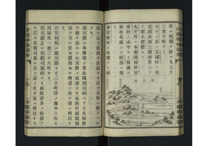
【右頁の下半分は図】運天港
枕ム。那覇ヲ距ル凡二十
二里十町ナリ。
オツパ岳ハ玉城(タマグスク)村ノ南。
名護本部二間切界ニア
リ。樹木 攅鬱(サンウツ)セリ。
大井(オホヰ)川ハ本部間切 伊豆(イヅ)
味(ミ)村ノ山中ヨリ發源シ。
曲折北流シテ。炬(テー)湊ニ落
ツ。
仲宗根(ナゾネ)村ニ海灣アリ。炬
湊ト云フ。底淺ク浪高キヲ以テ。大船ハ繫クヘカ
ラス。
運天港ハ本間切ノ東北隅運天村ニアリ。大船數
十艘ヲ泊スヘシ。天然ノ良港ナリ。永萬中、源爲朝
運ヲ天ニ任セ、漂着セシ所。港ノ名ヲ得ル所以ナ
リ。
古宇利島ハ運天港ヨリ、二十町許ノ海中ニ在リ。
周回凡一里二十六町ナリ。
運天港上ニ百按司墓山アリ。山腹許多ノ髑髏ア
リ。之ヲ百按司墓ト云フ。山ノ名ヲ取ル所以ナリ。
現代語訳
【右頁の下半分は図】運天港
面している。那覇から約二十二里十町の距離である。
オッパ岳は玉城(タマグスク)村の南、名護・本部の二間切の境界にある。樹木が密生している。
大井(オオイ)川は本部間切の伊豆味(イズミ)村の山中より発源し、曲がりくねって北に流れ、テー湊に落ちる。
仲宗根(ナゾネ)村に海湾がある。テー湊という。底が浅く波が高いため、大船は繋ぐことができない。
運天港は本間切の東北隅の運天村にある。大船数十艘を泊めることができる。天然の良港である。永万年間(1165-1166)に、源為朝が運を天に任せて漂着した所である。港の名前の由来である。
古宇利島は運天港から二十町ほどの海中にある。周囲は約一里二十六町である。
運天港の上に百按司墓山がある。山腹に多くの髑髏がある。これを百按司墓という。山の名前の由来である。
英語訳
[The lower half of the right page is a diagram] Unten Port
It faces the sea. It is about twenty-two ri and ten chō from Naha.
Mount Oppa is south of Tamagusuku Village, at the border between the two magiri of Nago and Motobu. Trees grow densely there.
The Ōi River originates in the mountains of Izumi Village in Motobu magiri, flows north in meandering curves, and empties into Te Port.
There is a bay in Nakazonene Village called Te Port. Because the bottom is shallow and the waves are high, large ships cannot be moored there.
Unten Port is located in Unten Village at the northeastern corner of this magiri. It can accommodate several dozen large ships. It is a natural good harbor. During the Eiman period (1165-1166), Minamoto no Tametomo entrusted his fate to heaven and drifted ashore here. This is the origin of the port's name.
Kouri Island is located in the sea about twenty chō from Unten Port. Its circumference is about one ri and twenty-six chō.
Above Unten Port is Mount Hyakuanji-baka. There are many skulls on the mountainside. This is called Hyakuanji-baka (Tomb of a Hundred Lords). This is the origin of the mountain's name.